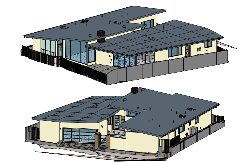
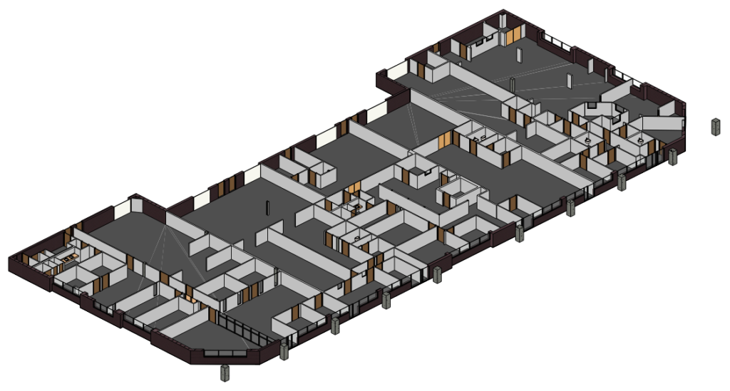
Every project starts with knowing exactly what exists today. Our as-built laser scanning for construction provides contractors, architects, and owners with complete documentation of existing conditions. The result is fewer change orders, reduced rework, and smoother permitting.
For advanced capture and coordination projects, visit our 3D Laser Scanning services page for industrial-grade scanning and data registration.
Outdated or incomplete drawings create risk for both commercial and residential projects. Missing walls, hidden utilities, or inaccurate dimensions lead to delays, cost overruns, and miscommunication. Our scanning services eliminate that guesswork by capturing every detail of the site in precise digital form.
With a verified model of existing conditions, your team can:
Plan with confidence
Detect clashes before they happen
Bid accurately
Reduce costly site revisits
Our workflow delivers more than a point cloud. We provide as built drawings for permitting, record drawings, floor plans, elevations, and BIM models that integrate directly into your coordination process.
Point cloud as built modeling: dimensional accuracy for CAD or BIM
As built drawings for permitting: trusted documentation to satisfy county or city requirements. If your jurisdiction requires a licensed surveyor stamp, we can coordinate that service
Construction documentation services: record drawings, permit ready plans, and existing condition drawings for approvals
Scan to BIM for construction: integration into coordination platforms to reduce RFIs and subcontractor conflicts
On the commercial side, scanning helps contractors and facility managers manage large complex spaces. From office towers to industrial plants, our scans deliver:
Documentation for tenant improvements
BIM coordination from scans to align multiple trades
Clash detection before crews mobilize
Existing conditions records for facility operations and maintenance
Construction verification scanning to confirm work matches design intent
For residential construction, scanning is equally valuable. From remodels to new builds, homeowners and contractors rely on accurate as built data for:
Floor plan creation and remodel approvals
Existing condition drawings for permitting and design
Capturing complex rooflines or mechanical layouts
Avoiding delays caused by missing or inaccurate measurements
Construction site scanning process
Our process is straightforward:
Assessment and planning – define the areas to be scanned
On site scanning – capture all visible conditions quickly and safely
Processing and alignment – register, clean, and verify the data
Data delivery – point clouds, BIM models, CAD, permit ready drawings, and record drawings
Integration support – ensure your team uses the data effectively
Reduce rework and change orders before they impact the schedule
Shorten permitting cycles with accurate as built and permit ready drawings
Lower costs with construction verification scanning
Improve coordination between field and office using BIM from scans
Deliver measurable savings in both commercial and residential projects
Q1. Are as built drawings accepted for permitting
A1. Yes. Our as built drawings are widely accepted for permitting. If your jurisdiction requires a licensed surveyor stamp, we can coordinate that service as a separate option.
Q2. How accurate is laser scanning compared to traditional methods
A2. Our scans capture building surfaces to within a few millimeters, far more precise than manual tape or disto measurements.
Q3. How does this help general contractors
A3. With verified as built data and BIM coordination from scans, contractors avoid guesswork, reduce RFIs, and keep subcontractors aligned.
Q4. Do you provide deliverables that work with both commercial and residential needs
A4. Yes. We provide CAD, BIM, point clouds, permit ready drawings, and record drawings adaptable to both commercial and residential projects.
Q5. How quickly can scans be completed
A5. Most residential or mid size commercial buildings can be scanned in a single day, with deliverables ready within days.
Request a quote today and see how as built laser scanning for construction supports both commercial and residential projects with accuracy, efficiency, and confidence.
GDS provides as-built 3D laser scanning services for construction projects, delivering precise point clouds, BIM models, and digital twins of existing conditions. This gives contractors, architects, and owners complete and accurate documentation of current site conditions — helping reduce change orders, rework, and permitting delays throughout the project lifecycle.
Every construction project benefits from knowing exactly what exists before starting modifications. GDS’s scans capture every detail of a site, eliminating guesswork from outdated or incomplete drawings. This removes surprises like hidden utilities or incorrect dimensions — avoiding delays and cost overruns that arise from unforeseen site conditions discovered during construction.
With a verified 3D model of existing conditions, your team can plan with confidence, detect clashes before they happen, bid accurately, and reduce costly site revisits. Design and coordination decisions are based on reality rather than assumptions — improving efficiency, preventing errors, and giving all project stakeholders a single reliable source of truth.
GDS delivers more than raw point clouds. Depending on project needs, deliverables include as-built drawings (floor plans, elevations, and permit-ready plans), 3D BIM models, and record drawings integrated into your coordination workflow. Where required by local jurisdictions, GDS can also coordinate licensed surveyor stamps to ensure drawings meet regulatory requirements.
For commercial projects such as office towers, retail centers, and hospitals, GDS delivers documentation for tenant improvements, BIM coordination to align multiple trades, and clash detection before crews mobilize. Construction verification scans confirm that work in progress matches design intent — preventing expensive fixes later and providing existing-condition records for ongoing facilities management.
Yes. Residential builders and homeowners benefit from GDS’s scanning for floor plan creation, remodeling approvals, accurate permit drawings, and capturing complex roof or mechanical layouts. Having an accurate as-built model means smoother design, faster permits, and fewer measurement-related delays — even for smaller home renovation and addition projects.
GDS follows a clear five-step process: Assessment and Planning (define areas to scan and deliverable requirements); On-site Scanning (rapidly capture all visible conditions); Processing and Alignment (register scans, clean data, verify accuracy); Data Delivery (provide point clouds, BIM models, CAD files, and permit-ready drawings); and Integration Support (help your team use the data effectively within existing workflows).
GDS’s services reduce rework and change orders before they impact the schedule, shorten permitting cycles with accurate as-built documentation, lower costs by catching issues early through verification scanning, and improve coordination by providing a single reliable model for both field and office teams. Together, these factors deliver measurable time and cost savings across the entire project.
Yes. GDS’s as-built drawings are widely accepted for permitting purposes. If a local jurisdiction requires a licensed surveyor’s stamp on the drawings, GDS can coordinate that service as well — ensuring all deliverables meet the specific regulatory requirements of the project location without additional steps for the client.
Many residential or mid-size commercial buildings can be scanned in a single day, with processed deliverables such as models or drawings ready within a matter of days. This rapid turnaround means even fast-track projects can gain the benefits of accurate as-built data without significant delays — keeping construction schedules on track from the start.
We build virtual products
GDS provides 3D laser scanning, 3D modeling, reverse engineering, and digital twin planning.
Talk about your project live on WhatsApp now!