

Infrastructure, whether public, private, or corporate, requires more than documentation. Owners, operators, and project leaders need reliable data, tailored accuracy, and deliverables that integrate directly into existing workflows. Global Design Solutions provides as-built laser scanning for infrastructure, as-built 3D modeling and drawings, and Digital Twin services that help organizations plan, modernize, and optimize their most critical assets.
We consult, plan, align, collect, manage, process, and deliver data in the formats and platforms that matter most to our clients. Each project follows a clear, proven process to reduce risk, ensure quality, and support both immediate decisions and long term asset strategies.
Consult – Discovery sessions to define project goals, accuracy requirements, and deliverables.
Plan – The scope, data collection strategy, and integration approach are mapped out.
Align – Reference systems and survey controls are established to tie data into client baselines.
Data Collect – Assets are captured with 3D laser scanning, photogrammetry, and survey grade methods.
Manage – Large datasets are organized, validated, and structured for clarity and long term use.
Process – Data is transformed into CAD, BIM, GIS, and VR/AR ready deliverables.
Deliver – Outputs are provided in the formats and platforms requested by the client, with QA/QC checks.
Support – GDS provides ongoing assistance for integration, updates, and future expansion.
Roads and Highways – As built surveys, volumetric cut and fill analysis
Bridges – Structural inspections, deformation monitoring, texture mapping
Power Generation – Plant layouts, turbine and boiler scans, equipment placement
Transmission and Distribution – Line sag measurements, tower inspections, route planning models
Renewable Energy – Wind farm optimization, solar array documentation, inspection scans
Water Supply Systems – Valve inspections, pump station scans, treatment plant documentation
Wastewater Treatment Plants – Equipment layouts, process documentation, compliance ready models
Telecommunications Networks – Tower inspections, structural scans, photogrammetry documentation
Broadband Internet – Fiber optic cable route surveys, planning tools for network expansion
Schools and Educational Facilities – As built surveys for renovations, virtual campus models
Hospitals and Healthcare Facilities – Facility layouts, equipment placement, and maintenance planning
Smart Grids – Monitoring power infrastructure with 3D scans and Digital Twin simulations
Intelligent Transportation Systems – Traffic flow simulations, photogrammetry for planning
Collaboration Platforms – Virtual environments for multi stakeholder planning
Metrology Services – High accuracy verification for joint ventures and shared projects
Airports – Terminal layouts, runways, baggage systems, passenger flow models
Seaports – Dock and berth scans, crane layouts, cargo yard optimization
Rail and Intermodal – Freight hub alignments, yard scans, station modernization
Logistics Hubs – Warehouse layouts, vehicle tracking, throughput simulations
Parks and Recreation – Buildings, monuments, trail networks, heritage sites
County Assets – Courthouses, libraries, small utility systems
State Assets – Roads, bridges, schools, hospitals
Federal Assets – Military bases, secure facilities, national parks, federally funded transport projects
Facilities – Server farm layouts, cooling systems, capacity expansion planning
Optimization – 3D scans for data center space management and simulation
Distribution Centers – Layout optimization, metrology for construction accuracy
Logistics Hubs – Flow simulations and digital models for planning efficiency
Facility Documentation – Scanning plants, production lines, and equipment layouts
Metrology and Inspection – High accuracy measurements for quality control and compliance
Reverse Engineering – CAD ready models from existing parts without drawings or OEM support
Asset Digitization – Corporate assets digitized for long term tracking and integration into enterprise systems
Rapid Replacement – Scanning and modeling failed or worn parts for quick reproduction and reduced downtime
Accuracy: Every project is scoped to meet the client’s requirements. Tolerances are defined up front and delivered with confidence.
Compatibility: Deliverables are provided in the formats and platforms clients specify, including CAD, Revit, IFC, BIM, and GIS.
Security: ITAR compliant workflows and strict governance protect sensitive infrastructure data.
Efficiency: Our structured process reduces downtime, improves planning, and helps extend the life of assets.
Collaboration: Models that align owners, engineers, contractors, and operators into a single source of truth.
Experience: GDS builds the right team for each project by aligning trusted professionals with proven expertise. This ensures specialized knowledge is applied where it matters most, while GDS remains the single point of responsibility for the client.
If you are responsible for planning, operating, or modernizing infrastructure, GDS provides the process, the expertise, and the precision to support your work. Contact us today to schedule a consultation and see how accurate data and Digital Twin solutions can support your next project.
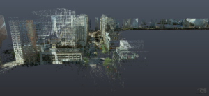
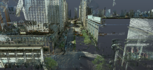
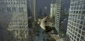
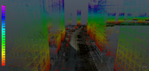

Infrastructure and Strategy
Pioneering Digital Landscapes

De-construct your world
Virtual asset assistance
GDS provides as-built laser scanning, 3D modeling, and digital twin services for all types of infrastructure — ensuring owners and project leaders have reliable, precise data integrated into their workflows. Beyond simple documentation, GDS delivers tailored accuracy and outputs like CAD and BIM models that plug directly into existing infrastructure management and planning processes.
GDS follows a clear, proven process: Consult (define goals, accuracy needs, and deliverables), Plan (map scope and data collection strategy), Align (establish reference systems and survey controls), Collect (capture assets with 3D laser scanning and photogrammetry), Manage (organize and validate datasets), Process (transform data into CAD, BIM, and GIS deliverables), and Deliver (provide outputs with full QA/QC). Ongoing support for data integration is also available after delivery.
GDS serves a broad range of sectors: transportation (roads, highways, bridges), energy (power plants, transmission lines, renewables), water and sanitation (supply and wastewater facilities), communications (telecom towers, fiber routes), social infrastructure (schools, hospitals), smart cities (intelligent transport and grid systems), airports and seaports, government and parks, data centers, logistics and warehousing, and manufacturing plants. Any infrastructure requiring precise spatial data falls within GDS’s scope.
Organizations choose GDS for accuracy (projects scoped to defined tolerances), compatibility (deliverables in CAD, Revit, IFC, GIS, and other formats), security (ITAR-compliant workflows and strict data governance), efficiency (structured processes that reduce downtime and extend asset life), collaboration (models serve as a single source of truth for all stakeholders), and experience (specialized experts assembled for each project type).
GDS employs scalable methods including vehicle-mounted or aerial LiDAR for highways and runways, and terrestrial scanning for detailed areas like terminals or bridge decks. Survey control is established across the entire project so all segments — each road section, concourse, or span — are stitched into one unified coordinate system, delivering a seamless final model regardless of scale.
Yes. GDS delivers models and data in the formats clients request — including BIM models in Revit or IFC for maintenance systems, and GIS-compatible datasets for enterprise platforms. By providing standardized, structured data, GDS ensures that digital infrastructure models can plug directly into existing asset management systems, digital twin dashboards, and maintenance scheduling software.
Yes. GDS sets the stage for ongoing monitoring through change detection algorithms that compare scans over time, and digital twin planning that emphasizes version control and continuous updates. Once a baseline is established, GDS can support periodic rescans or sensor data integration — enabling detection of structural movement in a bridge, pavement wear, or other asset changes over time.
GDS has executed large, complex infrastructure projects — including a $4M installation at LAX Airport completed with zero contingency usage and only 25% of planned manpower, meeting all schedule and quality requirements. This demonstrates GDS’s ability to handle major infrastructure undertakings with remarkable efficiency and precision, saving clients significant time and cost.
GDS uses AI-powered checks and rigorous QA/QC at every stage to uphold data accuracy. Survey controls tie the model to real-world coordinates precisely, point clouds are cleaned and validated, and consistency is verified throughout processing. This ensures that every decision made from the data — for design, repairs, or expansion — is based on trustworthy, verified information.
Reach out to GDS for a consultation. GDS will discuss your project’s scope, goals, and any regulatory or accuracy requirements — then map out a plan covering scanning methods, deliverable formats, and timeline, followed by a formal proposal. The first step is a discovery session to ensure GDS’s solution is fully tailored to your infrastructure project’s specific needs and objectives.
We build virtual products
GDS provides 3D laser scanning, 3D modeling, reverse engineering, and digital twin planning.
This will close in 0 seconds
This will close in 0 seconds
This will close in 0 seconds
This will close in 0 seconds
Talk about your project live on WhatsApp now!