

A facility manager opens a drawing set from years ago and immediately sees three problems: the title block is old, half the renovations are missing, and nobody knows which redlines were ever incorporated. A contractor is asking for dimensions. Engineering needs ceiling heights and column positions. Operations needs to keep the building running while the project team designs around information no one fully trusts. That is the point where outdated documentation stops being an inconvenience and becomes a business risk.
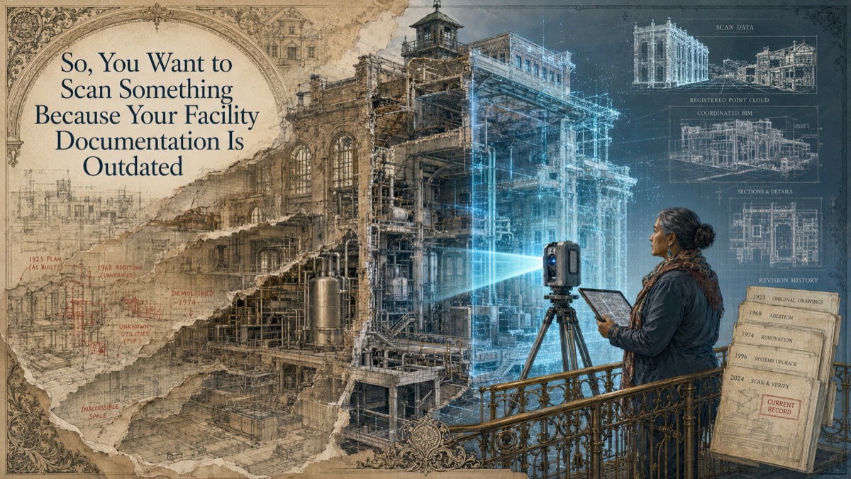
Laser scanning helps rebuild the record from the physical facility itself. It creates a dated, measurable baseline of visible and accessible conditions, which can then be converted into point clouds, 2D drawings, 3D models, BIM, sections, elevations, or planning exhibits. The scan does not magically recover concealed systems or undocumented design intent, but it gives the team a stronger foundation than memory, old PDFs, and selective hand measurements.
Key Takeaway
Laser scanning can rebuild a dated, measurable record of visible facility conditions, but the record is only useful when its coverage, coordinate basis, deliverable, intended users, and update responsibility are clearly defined.
The Facility Documentation Crisis
This is why GDS treats scanning as a decision-support workflow, not just a technical field activity. The question is not simply, "Can we scan it?" The more useful question is, "What decision must the data support, and what evidence will make that decision safer?"
Why Old Drawings Become a Project Risk
Facility drawings get out of date for normal reasons: small projects happen quickly, emergency repairs are undocumented, tenant improvements are marked up in separate folders, and maintenance changes do not always make it back into the master set. The longer the facility operates, the wider the gap becomes between the drawing and the building.
That gap affects design, budgeting, safety planning, permitting, and procurement. A remodel team may design from a reflected ceiling plan that ignores added ductwork. A contractor may price work based on room dimensions that changed during previous fitouts. A buyer may review an asset with incomplete spatial information. In each case, the risk is not that a drawing exists; the risk is that people believe it more than the building.
The Five-Phase Facility Documentation Recovery Pipeline
Phase 1 - Identify the decisions the record must support
Do not begin with a broad request to scan the building. Start with the decisions that need better information: renovation design, leasing, equipment replacement, code review, asset sale, insurance record, or facilities management.
Phase 2 - Review existing records without trusting them blindly
Existing drawings are still useful because they reveal names, room numbers, system intent, and likely hidden conditions. Treat them as context, not proof, until measured conditions confirm them.
Phase 3 - Capture visible conditions by zone
Scan logical zones such as floors, production areas, plant rooms, above-ceiling spaces, roofs, corridors, and exterior interfaces. Record exclusions, inaccessible areas, and obstructions so future users understand what the dataset can and cannot answer.
Phase 4 - Register, classify, and convert the data
The point cloud is registered into a controlled coordinate system, cleaned, checked, and converted into the deliverables the team can actually use: drawings, model, sections, or a searchable spatial record.
Phase 5 - Govern the record going forward
The updated documentation should enter the facility document register with capture date, revision, source, limitations, and update triggers. Without governance, today’s accurate record becomes tomorrow’s outdated drawing.
What Scanning Provides That Manual Re-Survey Usually Cannot
Manual measurement is still useful for selected checks, but it does not capture the spatial relationships across an entire facility. A controlled scan can record walls, floors, columns, ceilings, equipment envelopes, exposed MEP, stairs, structure, openings, and visible routing in one coordinated dataset.
The value is not only speed. The value is traceability. A point cloud can be revisited later, sectioned, measured, modeled, and compared to future changes. A hand sketch usually cannot. When access and line of sight permit, the scan becomes the physical record that multiple teams can reference without re-measuring the same space repeatedly.
Choosing the Right Deliverable
The right deliverable depends on who will use the information. Facility managers may need clean PDF and DWG plans. Engineers may need point clouds, sections, elevations, or a Revit model. Designers may need a point cloud underlay. Owners may want a structured record that can be updated across future projects.
A point cloud preserves the most measurement evidence, but it may be hard for non-specialists to use. A 2D drawing is easier to share, but it contains interpretation. A BIM model is powerful for coordination, but it costs more and should be scoped by system, level of detail, and intended use. The safest approach is to define the user, decision, and deliverable before scanning begins.
Keeping the Record Current
A facility scan is a baseline, not a permanent truth. The record remains reliable only until physical changes occur. The document register should identify what was scanned, when it was scanned, what deliverables were created, what areas were excluded, and what types of future work require an update.
A simple rule helps: if a project moves walls, changes MEP, replaces equipment, alters access routes, modifies structural interfaces, or affects leased areas, decide whether the drawing, model, or point cloud needs a targeted update before the project is closed.
Interactive Project Readiness Check
Select the items your team has already defined. This planning aid does not determine technical acceptance or replace project scoping.
Quick Facts
Continue Reading
The next best article depends on where you are in the project. These suggested reads connect this topic to the next practical decision your team is likely to face.
Frequently Asked Questions
Do outdated drawings still have value?
Yes. Existing drawings provide context, naming, likely system intent, and a starting point for scope planning. They should be treated as reference material until measured conditions confirm what is still accurate.
What is the best deliverable for facility documentation?
The best deliverable depends on the user. Point clouds preserve measurement evidence, 2D drawings are easier for many facility teams, and BIM models support coordination and future design when the added modeling effort is justified.
Can scanning happen in an occupied facility?
Often, but access, safety, privacy, obstructions, operating equipment, and restricted rooms should be planned before mobilization. Occupied conditions should be documented as part of the scan limitations.
Does a scan replace all existing drawings?
No. A scan-derived package should supersede only the elements it actually captured and processed. Drawings that contain concealed system logic, design intent, or equipment data may still be needed.
How often should facility records be updated?
Records should be updated after meaningful physical changes, especially work that affects walls, MEP routing, equipment, access paths, safety systems, or leased-area boundaries.
Connect this article to the right GDS workflow
Most physical-to-digital projects touch more than one service. GDS can help determine whether the right starting point is 3D laser scanning, 3D modeling, reverse engineering, or consulting before scope, pricing, schedule, and deliverables are finalized.
GDS provides nationwide project coverage. Current examples from the GDS locations page include Houston, Dallas, Los Angeles, and Fort Worth.
Ready to Start?
Tell GDS about your asset, your goals, and your deliverable needs. GDS can scope the right scanning, modeling, and reporting for your project.