

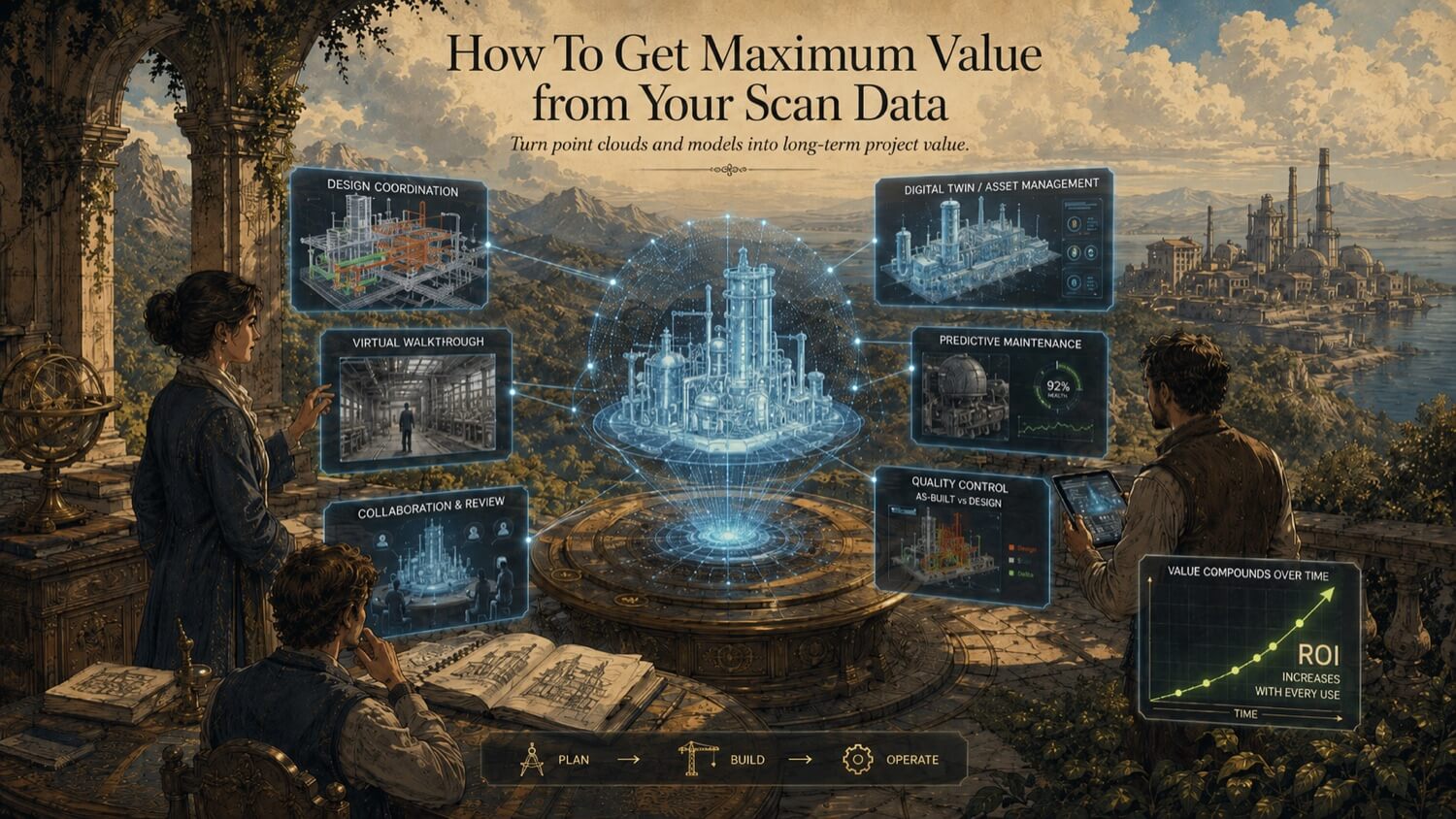
Most organizations that commission a 3D scanning project have one immediate goal. They need as-built drawings for a renovation. They need a model for a fabrication job. They need to verify an existing condition before engineering begins. They get what they asked for, use it for that project, and file the data away.
That is one of the most common , and costly , mistakes in the scanning industry. Not because the data was misused. Because it was under-used.
Scan data is not a single-use document. It is a persistent digital record of your physical asset at the moment it was captured. That record has value not just to the team that commissioned it, but to every subsequent engineering project, operations function, maintenance programme, and capital planning exercise that involves that asset. The question is not whether your scan data has additional value , it almost certainly does. The question is whether you are structured to capture that value.
This article shows you how.
Why Scan Data Gets Under-Used
Before examining the applications, it helps to understand why most organizations fail to extract full value from their data. The causes are almost always structural rather than technical:
The data lives in one department. Scan data is typically commissioned by engineering or project teams. Operations, maintenance, and facilities teams may never know it exists, have access to it, or understand how to use it.
The deliverable format doesn't match downstream needs. An engineering team may receive a point cloud in E57 format , which is technically correct for their use case but inaccessible to a maintenance planner who works in a CMMS with no point cloud integration.
Nobody is assigned to manage the data after delivery. Scan data without a custodian is scan data that gets forgotten. Without a named owner responsible for making it available, it drifts into an archive folder and stays there.
The value beyond the primary use case was never mapped. When a project is scoped, the deliverables are defined for the immediate need. Rarely does anyone ask: who else on this team could benefit from this data, and in what format would they need it?
The good news: all of these are solvable with modest effort, and most do not require any additional scanning.
Six High-Value Applications Beyond Your Primary Project
1. Engineering Reference for Future Projects
The most immediate reuse opportunity is the simplest. Any engineering project , renovation, modification, expansion, tie-in , that involves the same asset or facility may need the same as-built information. If you already have a registered point cloud or a 3D model, future engineering teams have a ready-made starting point.
What this means in practice: When you commission scanning, document the data location, coordinate system, and file formats in your project document management system under the asset record , not just under the project folder. When the next project team comes along asking for as-built drawings, they find the existing data instead of commissioning a new scan.
This is not hypothetical. A 5,000 m² process facility that has been scanned once has data that may serve 10 to 20 subsequent engineering scopes before the physical asset changes enough to require a rescan. At a fraction of the original scan cost per reuse event, the ROI accumulates rapidly.
2. Fabrication and Construction Planning
If your initial deliverable was a 2D drawing package, the underlying point cloud or 3D model may be directly usable for fabrication scope that wasn't part of the original project.
A point cloud that was captured to document existing piping in a process plant, for example, contains geometry that a fabrication team could use to model a new pipe spool route , measuring clearances, checking conflicts, and establishing tie-in dimensions , without returning to site. The data may already be there. It still needs to be checked for coverage, currency, and suitability before being reused.
Work with GDS to understand what additional outputs are derivable from your retained scan data before scheduling a return mobilization.
3. Facility Operations and Space Management
Operations and facilities management teams deal daily with questions that scan data can answer precisely: How wide is that aisle? What clearance exists between that equipment and the structural column? Can we fit a new machine in that bay without moving existing equipment? Is that emergency egress route compliant?
A point cloud-derived floor plan , showing accurate equipment footprints, column positions, aisle widths, and overhead clearances , is a working tool for facility managers, not just a project document. In many cases, this is the highest-frequency reuse of scan data across the asset lifecycle.
4. Maintenance and Inspection Planning
Maintenance teams planning access, scaffolding, or shutdown work on complex plant benefit from having accurate spatial information before work begins. A point cloud allows a maintenance planner to virtually tour a structure, understand access constraints, identify clearance limitations, and plan scaffolding requirements , all without a physical site walk.
For ageing assets where the physical configuration has diverged from paper records (and it almost always has), the scan data can become one of the most useful spatial references available to maintenance teams.
Predictive maintenance programmes that incorporate 3D scanning go further , using scan data captured at intervals to detect dimensional changes (settlement, deformation, corrosion-related wall thinning) that would not be visible to a routine visual inspection.
5. Regulatory Compliance and Documentation
Many industries require demonstrable, documented evidence of existing conditions for regulatory compliance , HSE gap analysis, insurance valuations, fire egress compliance, environmental permitting, or asset transfer due diligence. Scan data can provide timestamped spatial documentation that supports these requirements more effectively than photographs or incomplete drawing records when the scope and acceptance criteria are clearly defined.
If your asset has undergone significant capital works, updating the scan record and maintaining a current as-built reference can support inspections, asset transfers, audits, and future engineering planning.
6. Digital Twin and BIM Integration
For organizations moving toward digital twin or BIM-based facility management, existing scan data is the starting inventory , the geometric foundation from which the digital twin is built. If you have a registered point cloud, you are closer to a digital twin than most organizations realize.
The path from point cloud to operational digital twin is not a single step , it involves data enrichment, system integration, and workflow change. But it starts with accurate geometry, and accurate geometry is what the scan provides. Organizations that treat their scan data as a digital twin seed asset rather than a project output are positioned to build that capability incrementally, at lower cost, and with less disruption than those starting from scratch.
See Article 37 for implementation guidance on integrating scan data into your existing project workflows.
Practical Steps to Extract More Value from Data You Already Have
Step 1 , Inventory what you have. List all scan projects completed in the past three to five years. Document the asset, the scan date, the deliverable formats, the coordinate system, and where the files are stored. Most organizations discover data they had forgotten about.
Step 2 , Identify current pain points that existing data might address. Talk to engineering, operations, maintenance, and facilities teams. Ask: what spatial questions do you answer inefficiently today? What would you do if you had an accurate as-built model? You may find that several current problems are already solved , the solution is just sitting in an archive.
Step 3 , Convert formats where needed. Point cloud data in E57 format used by an engineering team may need to be converted or simplified for use in a facilities management platform or a CMMS. GDS can advise on format options and perform conversions from retained data.
Step 4 , Assign a data custodian. Designate a named person or role responsible for maintaining the organization's scan data inventory, managing access, and ensuring new teams know existing data exists before commissioning new scans.
Step 5 , Build scan data into capital project planning. When future projects are planned, check the scan data inventory first. Scope a new scan only for areas not covered by existing data, and specify that new scans should be stored in a consistent format and location for future reuse.
Quick Facts
Continue Reading
The next best article depends on where you are in the project. These suggested reads connect this topic to the next practical decision your team is likely to face.
FAQ
How long does scan data remain accurate and usable?
Scan data of stable structures , concrete frames, foundations, fixed plant , typically remains accurate for many years provided the physical asset has not changed. Dynamic elements , equipment that is regularly moved, areas subject to construction activity, or assets subject to significant settlement or deformation , may need periodic rescan updates. For many industrial facilities, scan data can remain useful as a spatial reference while the physical asset remains materially unchanged. Teams should verify the current condition before using older data for high-impact design, fabrication, safety, or compliance decisions.
Can I get additional deliverables from existing scan data without a return site visit?
In most cases, yes , within the data retention period. If retained scan data has sufficient coverage, resolution, and context, additional drawings, models, or BIM elements may be produced from the existing data without a return site visit. Contact GDS with your additional deliverable requirements and GDS can confirm whether the existing data coverage appears sufficient or whether supplementary scanning may be needed.
What is the easiest way to share scan data with other teams who need it?
The approach depends on the receiving team's tools and technical capability. Point cloud viewers (such as Autodesk ReCap, Leica Cyclone Viewer, or CloudCompare , many of which are free) allow non-technical users to navigate and query the point cloud. GDS can also provide 2D PDF drawings or simplified 3D models in standard formats (STEP, OBJ, FBX) that open in widely available software without specialist point cloud tools.
Should we rescan periodically even if nothing major has changed?
For most assets, periodic rescan is warranted when the facility has undergone significant modifications, when your current scan data is more than five years old and significant decisions depend on its accuracy, or when you are initiating a digital twin programme and need a current baseline. For stable, low-change assets, periodic visual inspection and selective rescan of modified areas is often more cost-effective than full facility rescan.
Connect this resource to the right GDS workflow
These resource pages are intended to help teams make better planning decisions before a scope is finalized. GDS can help confirm whether the work should start with 3D laser scanning, continue into 3D modeling, require reverse engineering, or benefit from early consulting before budget, schedule, and deliverables are locked in.
GDS lists nationwide service coverage on its locations page, including posted major metropolitan areas such as Houston, Dallas, San Antonio, Austin, Los Angeles, San Diego, San Jose, Long Beach, Fort Worth, Irvine, Riverside, New Orleans, Baton Rouge, Shreveport, Las Vegas, and Beverly Hills.