

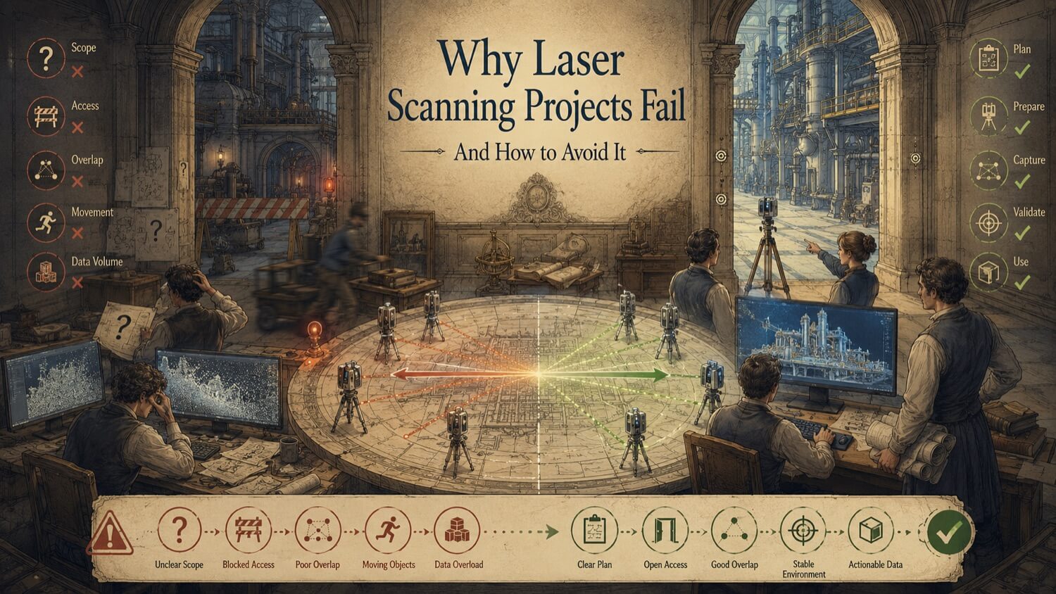
Laser scanning is an established, mature technology. Done correctly, it is one of the most reliable ways to capture spatial data quickly, accurately, and safely. Yet scan projects fail , not because the technology fails, but because the conditions surrounding the scan were not properly planned, communicated, or managed.
The good news is that virtually every scanning project failure is preventable. The causes are not mysterious. They appear repeatedly, in recognisable patterns, and they almost always originate at the planning stage , weeks before the scanner is even unpacked on site.
This article examines the eight most common failure modes, what causes them, what the consequences look like, and , most importantly , how to prevent every one of them.
Failure Mode 1 , Scope Is Defined Too Vaguely
What happens: The project brief says "scan the facility" or "scan the production area" without defining which specific areas, which surfaces, which systems, or what accuracy is required. The scanning team and the client each have a different mental picture of what is included.
Consequence: The scan captures some of what was needed, misses other parts, and the deliverable does not support the engineering or design task it was commissioned for. A return visit is required , at additional cost and with schedule impact.
Prevention: Define scope in writing before mobilization: list specific areas by name or grid reference, specify included and excluded systems (structural, mechanical, electrical, piping), define the required accuracy class, and agree on what constitutes "complete coverage." Attach a marked-up site plan showing the scan boundary.
Failure Mode 2 , Wrong Technology Selected for the Application
What happens: A technology is selected based on familiarity, cost, or availability rather than fit-for-purpose assessment. A handheld scanner is used where a tripod-mounted terrestrial scanner is needed. Photogrammetry is used where the surface characteristics require active scanning. A single technology is specified where a hybrid approach would be necessary.
Consequence: The data does not meet the accuracy or coverage requirements. The scan must be repeated with the correct technology, or the deliverables are produced from lower-quality data than the application requires.
Prevention: Match technology to application. Article 32 provides a full guide to technology selection by application type. When in doubt, request a GDS technology recommendation as part of the pre-project consultation , this costs nothing and eliminates one of the most expensive failure modes in the industry.
Failure Mode 3 , Site Access and Preparation Fails on Scan Day
What happens: The scanning team arrives on site to find that access permits were not arranged, that the area is occupied by a contractor working unrelated scope, that equipment scheduled to be shutdown is still running, or that surfaces that were supposed to be exposed are still lagged or covered.
Consequence: The scanning team cannot capture what was planned. Either the scope is reduced to what is accessible (producing a partial dataset), the mobilization is aborted (wasting mobilization cost with zero deliverable), or the team waits , at day-rate cost , for conditions to be resolved.
Prevention: Treat site preparation as a formal project task with an assigned site contact, a pre-mobilization checklist, and a go/no-go gate 48 hours before scan day. Article 33 covers the full pre-mobilization preparation process in detail , including access, HSE, site conditions, and stakeholder coordination.
Failure Mode 4 , Deliverable Format Does Not Match the Recipient's Software
What happens: The point cloud is delivered in E57 format, but the engineering team only has software that reads RCP. The BIM model is delivered in Revit format, but the client's design team uses MicroStation. The drawing package is issued as DWG, but the recipient only has a PDF viewer.
Consequence: The data exists but cannot be used by the people who need it. Format conversion may introduce geometric degradation. Conversion software may not be available. Time is lost while the format problem is solved.
Prevention: Confirm software environments and required delivery formats during scope definition , before scanning begins. This is a one-sentence addition to the scope document: "Deliverables to be provided in [format] compatible with [software name, version]." GDS specifies and confirms delivery formats as part of every project kickoff.
Failure Mode 5 , Coordinate System Is Not Agreed in Advance
What happens: The scan is captured in an arbitrary or site-local coordinate system without agreement on the datum, projection, or relationship to the project model or survey control. When the data is loaded into the project environment, it sits hundreds of metres from where the model expects it , or not in any recognisable position at all.
Consequence: Integrating the scan data into the project model requires coordinate transformation work that may require a licensed surveyor. If control points were not set during scanning, the transformation may not be achievable with the required accuracy. The data may effectively be unusable for precision work.
Prevention: Specify the required coordinate system, datum, and any relationship to project survey control in the scope document. GDS will establish scan control in relation to the specified datum , either using provided survey control points or by establishing independent control with GNSS if required. Confirm the coordinate system before scan day, not after data delivery.
Failure Mode 6 , Registration Quality Is Not Verified Before Deliverable Production
What happens: The registered point cloud contains registration errors , individual scans that did not align correctly , that are not caught during internal QA. Deliverables are produced from the flawed registration. Dimensional errors propagate from the registration error into drawings, models, and fabrication data.
Consequence: Drawings or models contain incorrect dimensions. Fabricated components do not fit. The root cause , a registration error , may not be identified until components fail to install, by which point significant rework has been committed.
Prevention: GDS applies formal registration QA to every project , checking registration error reports, inspecting visually for misalignment, and applying a maximum tolerance. When commissioning scanning from any provider, ask for the registration error report as part of the deliverable package. A professional scanning firm should be able to demonstrate the registration accuracy of every project.
Failure Mode 7 , Insufficient Coverage of Critical Areas
What happens: The scanning plan did not adequately account for shadow zones , areas that were physically blocked from the scanner's line of sight by equipment, structures, or other obstructions. The delivered point cloud has coverage gaps in areas that are critical for the design or engineering task.
Consequence: The design team cannot extract the information they need from specific areas. A return visit may be required to capture supplementary data, or the design must proceed with lower-quality information than the task requires.
Prevention: During scope definition, identify critical areas and specific surfaces that must be captured with complete coverage. GDS will design a scan station layout that minimises shadow zones for those areas. For complex environments with many obstructions (dense pipe racks, congested mechanical rooms), discuss the scanning approach and expected coverage limitations before committing to scope. Some shadow zones are unavoidable , knowing their location in advance allows design to plan around them.
Failure Mode 8 , No Plan for Using the Data After Delivery
What happens: The scanning project is executed correctly. The data is delivered on time and in the correct format. But no one in the receiving organization has a plan for what to do with it. It goes into a shared drive folder. The engineer who was supposed to use it is now on a different project. Six months later, someone asks if there is scan data of that facility.
Consequence: A correctly executed scan project produces no value because implementation was never planned. The investment is functionally wasted, and the data ages while the situation it was captured to address remains unresolved.
Prevention: Before commissioning scanning, confirm that there is a named person responsible for receiving the data, loading it into the working environment, and producing the required outputs from it. See Article 37 for the full implementation guide , including pre-delivery planning, software setup, user distribution, and output production.
Summary , The Prevention Checklist
| Failure Mode | Prevention Action | When |
|---|---|---|
| Vague scope | Define scope in writing with area list and accuracy class | At project initiation |
| Wrong technology | Request GDS technology recommendation | Before quoting |
| Access and site preparation | Complete pre-mobilization checklist with go/no-go gate | 48 hours before scan day |
| Wrong delivery format | Confirm software environments and format in scope document | At project initiation |
| Coordinate system mismatch | Specify datum and relationship to project control | At project initiation |
| Registration errors not caught | Require registration error report as part of deliverable | At deliverable review |
| Coverage gaps | Identify critical surfaces; discuss shadow zones | During scan plan review |
| No implementation plan | Name data custodian; plan software setup before delivery | Before scanning begins |
Quick Facts
Continue Reading
The next best article depends on where you are in the project. These suggested reads connect this topic to the next practical decision your team is likely to face.
FAQ
What is a common cause of laser scanning project issues?
Poor scope definition is one of the most common root causes. When the scan scope is vague , covering 'the facility' without specifying which areas, which surfaces, which systems, and what accuracy , the scanning team and the client have different expectations. The delivered data meets the scanning team's interpretation of the scope but not the client's actual need. Defining scope in writing, with a marked-up site plan and agreed accuracy or acceptance requirements, greatly reduces this failure mode.
Can a failed scan project be recovered without re-scanning?
Sometimes. If the failure is a format or coordinate system issue, it can often be corrected by re-processing or transforming the existing data without returning to site. If the failure is a coverage gap in a critical area, a targeted return visit to scan just the missing area is may be more efficient than a full remobilization, depending on site access, coverage requirements, and schedule. If the failure is a registration error, correction may be possible from the raw data if individual scan files are retained. Contact GDS with a specific description of the problem before assuming a full rescan is required.
How do I know if a scan provider's registration quality is adequate?
Ask for the registration error report. Registration reporting should be discussed before the project begins. For some projects, a registration report, control summary, or quality review is appropriate and should define how alignment quality will be evaluated. Acceptable registration values vary by scanner type, site conditions, control method, deliverable, and downstream use, so project-specific acceptance criteria should be documented rather than assumed.
What should I do if deliverables arrive with obvious errors or coverage gaps?
Raise the issue immediately and in writing, within the agreed review window. Describe the specific problem , which area, which element, what the issue is , referencing the agreed scope document where relevant. GDS can review submitted comments under the agreed review process and respond based on the proposal, scope, deliverable specification, and available data. Do not begin design work from deliverables you have identified issues with until the issues are resolved.
Connect this resource to the right GDS workflow
These resource pages are intended to help teams make better planning decisions before a scope is finalized. GDS can help confirm whether the work should start with 3D laser scanning, continue into 3D modeling, require reverse engineering, or benefit from early consulting before budget, schedule, and deliverables are locked in.
GDS lists nationwide service coverage on its locations page, including posted major metropolitan areas such as Houston, Dallas, San Antonio, Austin, Los Angeles, San Diego, San Jose, Long Beach, Fort Worth, Irvine, Riverside, New Orleans, Baton Rouge, Shreveport, Las Vegas, and Beverly Hills.