

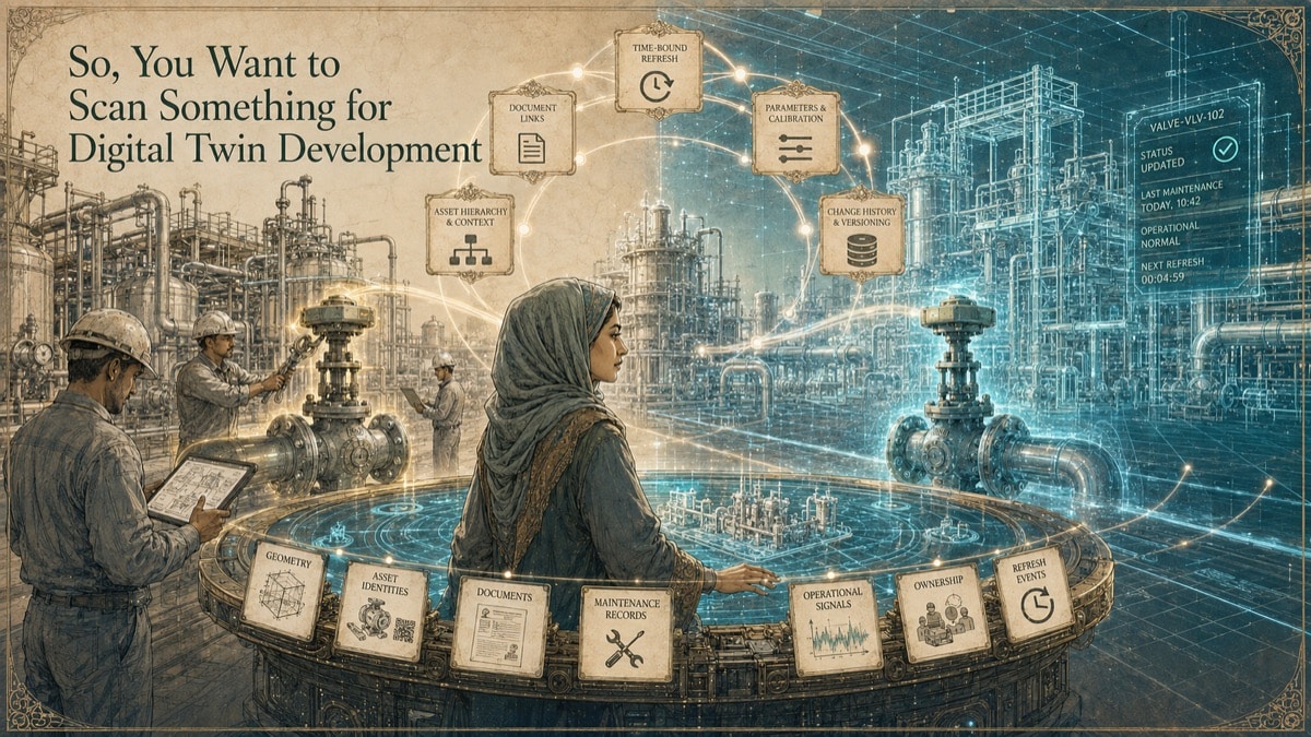
A leadership team approves a digital twin initiative. The first instinct is to scan the facility and build a detailed model. Months later, the team has files, viewers, and impressive screenshots, but maintenance still uses one system, engineering uses another, operations does not trust the asset data, and no one knows who updates the model after a field change. The scanning effort was real. The 3D model was real. But the twin was not operationally owned.
A digital twin is not just a point cloud, mesh, CAD model, BIM model, or viewer. Those can be important layers. A useful twin connects geometry, asset identity, documents, operational data, governance, update rules, and decisions people actually make.
Key Takeaway
A scan can be a foundational layer for a digital twin, but it is not the twin itself. The right deliverable, data governance, model status, update rule, and review responsibility should be defined before the organization relies on it.
The Digital Twin Problem: A Model Is Not a Twin
The phrase “digital twin” gets used for almost any 3D model. That creates confusion and waste. A static model may be valuable, but a twin needs purpose. It should support a defined decision or workflow: maintenance planning, remote review, retrofit design, clearance coordination, asset lookup, change control, or construction handover.
A point cloud records visible geometry at a moment in time. A mesh represents measured surfaces. CAD and BIM organize geometry into usable objects. Asset systems manage identity, work orders, maintenance records, and documentation. A twin becomes useful when these layers are governed together without confusing their roles.
This is why GDS starts digital twin planning with questions about purpose, ownership, asset scope, systems of record, and update triggers - not just scanner selection.
Define the Twin Before You Define the Scan
Before capture begins, the team should define what the twin must do. A facility-management twin may prioritize asset tags, locations, maintenance access, and CMMS links. An engineering twin may prioritize interfaces, tie-ins, model status, clearances, and revision control. A remote-operations twin may prioritize viewer performance, navigation, asset lookup, and current status indicators.
Five questions should be answered early:
1. Which decisions will the twin support? 2. Which assets, spaces, and systems are in scope? 3. Which system is authoritative for geometry, identity, documents, and operational data? 4. What event triggers an update? 5. Who reviews, approves, and publishes each revision?
Without those answers, the team may overbuild geometry while underbuilding governance.
The Seven-Phase Scan-to-Digital-Twin Workflow
Phase 1 - Define outcomes and users
Identify users, use cases, decision points, roles, and the minimum viable twin. Avoid building a maximum-detail model before proving what people will actually use.
Phase 2 - Create the data specification
Define units, coordinate system, accuracy tiers, model status, asset fields, naming rules, formats, ownership, update triggers, and acceptance criteria.
Phase 3 - Capture the physical baseline
Plan visible-condition capture around the approved use cases. Record access, line-of-sight limitations, equipment state, excluded areas, and change-sensitive zones.
Phase 4 - Develop geometry layers
Preserve the registered point cloud and create approved BIM, CAD, mesh, drawings, or simplified geometry. Keep measured and reconstructed geometry distinguishable.
Phase 5 - Map assets and systems
Connect approved asset identifiers to the correct systems of record without duplicating ownership unnecessarily. Geometry should point to authoritative data rather than becoming an uncontrolled database.
Phase 6 - Validate and publish
Test geometry, coordinates, asset links, permissions, viewer performance, naming, revision status, and user workflows before publishing.
Phase 7 - Refresh and govern
Define how field changes are detected, who authorizes updates, how superseded data is retained, and when recapture or remodeling is required.
Geometry, Asset Identity, and Governance
| Twin Layer | Purpose | Common Content | Risk if Undefined |
|---|---|---|---|
| Reality capture | Measurement evidence | Point cloud, imagery, control, capture date | Users cannot tell what was actually measured |
| Geometry model | Usable spatial representation | BIM, CAD, mesh, simplified envelopes | Model detail is mistaken for accuracy or authority |
| Asset identity | Connects model to records | Tag, class, location, owner, system | Duplicate IDs and stale records appear |
| Operational data | Represents activity or status | Work orders, alarms, inspections, sensor values | Live and historical data are confused |
| Governance | Preserves trust | Revision, approval, provenance, refresh rules | Twin becomes obsolete after the first field change |
Table accessibility note: Each row identifies a digital twin layer, its purpose, typical content, and the risk created when that layer is not defined.
How to Keep the Twin Useful After Launch
The hard part of a digital twin is not the first scan. The hard part is keeping the information useful after the facility changes. A trusted twin needs change triggers. Examples include equipment replacement, shutdown modifications, construction turnover, critical rerouting, relocation of assets, or periodic audit cycles.
The twin should also show confidence and status. Users should know whether geometry is measured, modeled, inferred, nominal, outdated, or pending review. The same applies to asset records and operational values. A model that hides uncertainty may look polished while becoming less trustworthy over time.
A phased pilot is usually more effective than an indiscriminate full-facility effort. Start with one use case, one area, and one set of users. Measure adoption, data exceptions, time saved, avoided rework, and update effort before scaling.
How GDS Supports Digital Twin Development
GDS can support the physical-to-digital foundation: 3D laser scanning, point-cloud registration, scan-derived CAD/BIM, reverse modeling, sections, drawings, and model-status documentation. GDS can also help plan capture boundaries, asset classes, deliverable architecture, QA criteria, and phased implementation roadmaps.
A good digital twin baseline should not promise more authority than it has. It should make the evidence, assumptions, and update rules visible.
Digital Twin Layer Builder
Add the information layers your organization can actually own and maintain. The result distinguishes a useful model from a governed twin.
Quick Facts
Continue Reading
The next best article depends on where you are in the project. These suggested reads connect this topic to the next practical decision your team is likely to face.
Frequently Asked Questions
Is a point cloud a digital twin?
No. A point cloud is a measured spatial record. A digital twin also needs users, asset identity, governance, operational data, and update rules.
Does a digital twin require real-time sensor data?
Not always. Data may be live, scheduled, event-driven, or manually governed. The update frequency should match the decision being supported.
How much of a facility should be scanned?
Scan the areas needed to support approved use cases, plus contextual geometry that can affect those decisions. Phased capture is often more maintainable than indiscriminate full-site capture.
Can GDS update an existing BIM or CAD model from a scan?
Yes, when the existing file, model condition, scope, and change rules support it. Updates should distinguish measured changes from assumptions and preserve revision history.
How often should a twin be refreshed?
Use event-based triggers whenever possible, such as equipment replacement, shutdown modifications, construction turnover, critical rerouting, or a defined audit cycle.
Connect this article to the right GDS workflow
Most physical-to-digital projects touch more than one service. GDS can help determine whether the right starting point is 3D laser scanning, 3D modeling, reverse engineering, or consulting before scope, pricing, schedule, and deliverables are finalized.
GDS supports projects nationwide. Examples from the current locations page include Houston, Dallas, Austin, and Fort Worth.
Ready to Start?
Tell GDS about your asset, your goals, and your deliverable needs. GDS can scope the right scanning, modeling, and reporting for your project.